Superior Hiking Trail Map by Myrmel Maps
Product Description
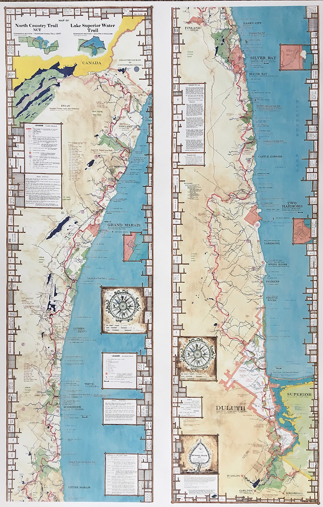
This 2019 map has the full 310 mile length map #8 of the Superior Hiking Trail (SHT), plus the Lake Superior Water Trail along the North Shore for kayaking and canoeing. Waterproof map.
A detailed waterproof map with full information on distances, campsite facilities, Trailhead/Parking areas, and locations of waterfalls with elevations, Parks, mountain elevations, and more.
Map size = 25" x 39"
Printed 2017, 2019
This map can be cut in half and pieced together to make it 12" x 6.5'
Made by a Minnesotan, printed in Minnesota entirely a USA product
Price includes tax and shipping in USA.
Product Details
Approx. Price:
$34.00 (Click to View Price Changes and Options)
Brand:
Myrmel Maps
SKU:
MM02
Manufacture ID:
180
Reviews for Superior Hiking Trail Map
No Reviews -